2017 OBX Hurricane Updates Blog
 9/25/17 8:49am: The Outer Banks are under a Tropical Storm Warning. This means tropical storm force winds are expected within the next 24 hours. The forecasted path for Maria is tightening up and seems to agree she will stay offshore, but close enough to impact us with winds from 30-73mph. Storm surge forecasts are much less than that of a hurricane hitting straight on, but unnecessary travel from late this afternoon through Wednesday along the beach road should be avoided if possible. Our neighbors to the south on Ocracoke Island have given visitors a mandatory evacuation order as they are typically more severely impacted by storms like these, especially since emergency assistance, electricity and other services are in smaller supply and take longer to be restored. Dare County Emergency Management is meeting this morning and we will update this blog, our social media pages, and guests via our Glad To Have You smartphone application if any important updates become available. Otherwise, please prepare for high winds and surf, and take wise precautions like avoiding travel and staying indoors until it passes. The weather is expected to be beautiful after Wednesday!
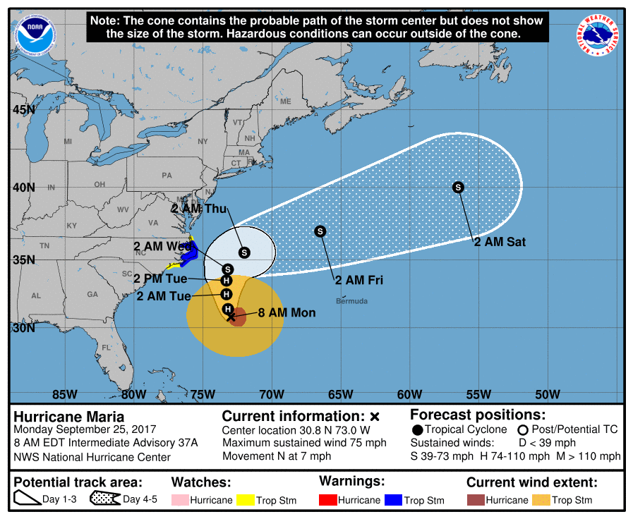
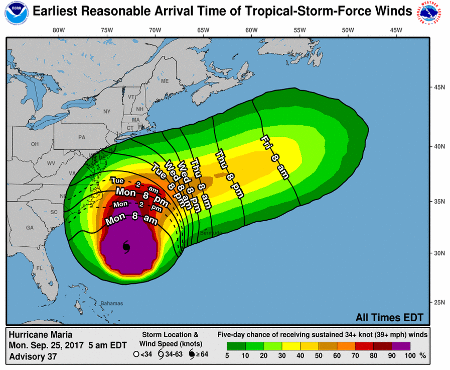
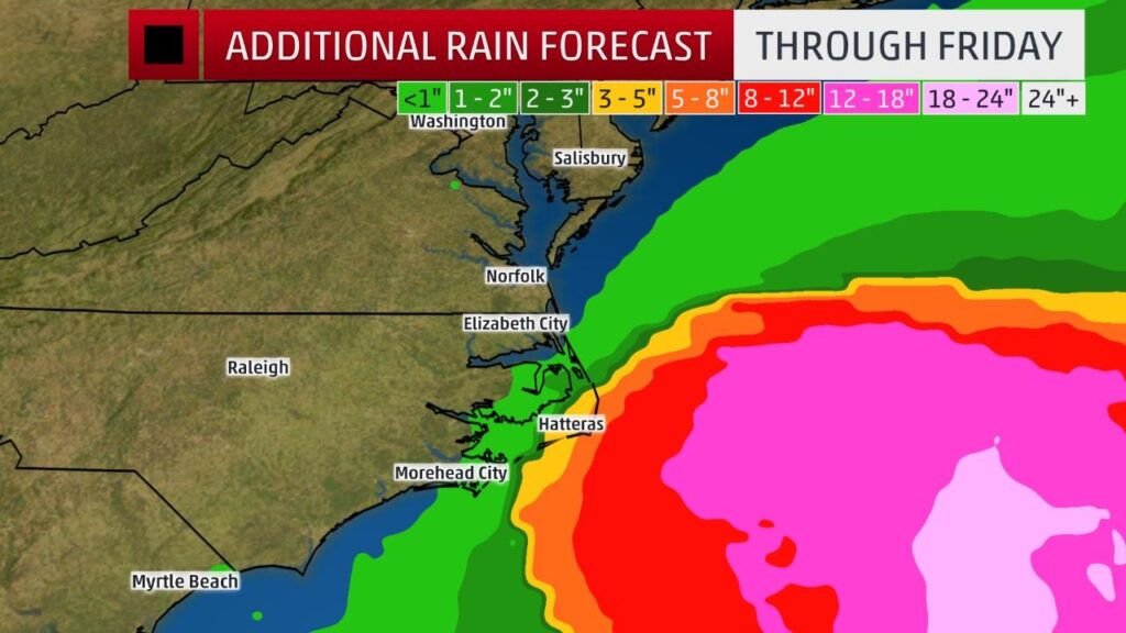 9/23/17 5:38am: Watching the latest forecast shows a westward trend in the models. We will be paying close attention to Maria over the next 24-48 hours and keep updating everyone if any impact is expected. Please make sure you have the Glad To Have You application installed on your smartphones if available and checking-in to a Village Realty Rental this weekend.
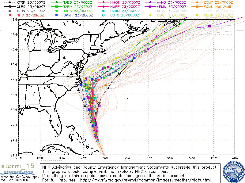 9/21/17 9:37am: Forecasts and models are tightening up for Maria, and all signs seem to indicate she'll stall well offshore with minimal effects to the Outer Banks. The Bermuda High (Azores High) pressure zone is letting up a bit and should allow jet streams keep the storm away from the coast. It would not be unusual if the forecast changed a bit in the coming days, but it would most likely not be dramatic enough where we are facing an immanent impact.
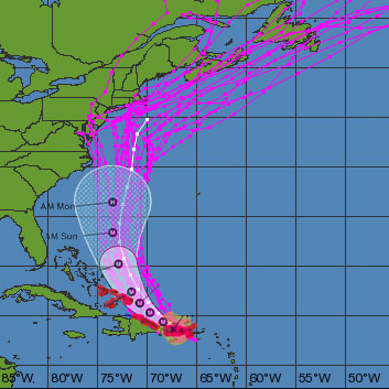
 9/20/17 12:04pm: Maria is currently battering Puerto Rico and our thoughts are with all of those affected by this second major hurricane in such a short span of time. Below is a unique look at the combined National Hurricane Center and spaghetti model forecasts to better understand the projected path of the storm. Although the cone of uncertainty is close to the coast, the majority of models still show an offshore track that would be very minimal impact to the Outer Banks. We should know much more by the weekend and will keep updates coming.
 9/19/17 4:20pm: Here is some footage of Jose today at the Avalon Pier in Kill Devil Hills. Many waves were spotted breaking near the top of the pier and seafoam churned as far as the eye could see!
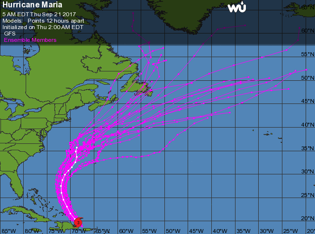
Some good news on the Maria front, the majority of new ensemble models show the storm staying far from the coast of the US. We will continue to monitor and report updates.
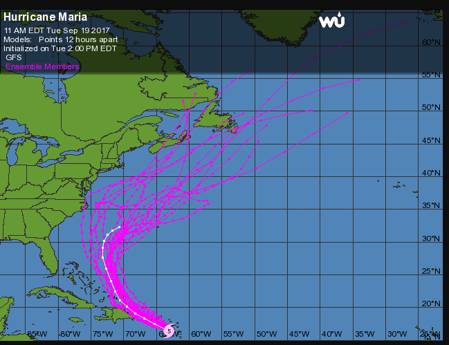 9/19/17 8:17am: Jose is now giving the Outer Banks the best dose of his winds... the surf continues to churn and wind speeds are noticeably higher than yesterday. There still is no immanent threat of damage, just some minor tidal flooding taking place in Rodanthe and other low/no dune areas.
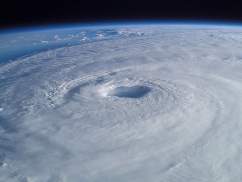
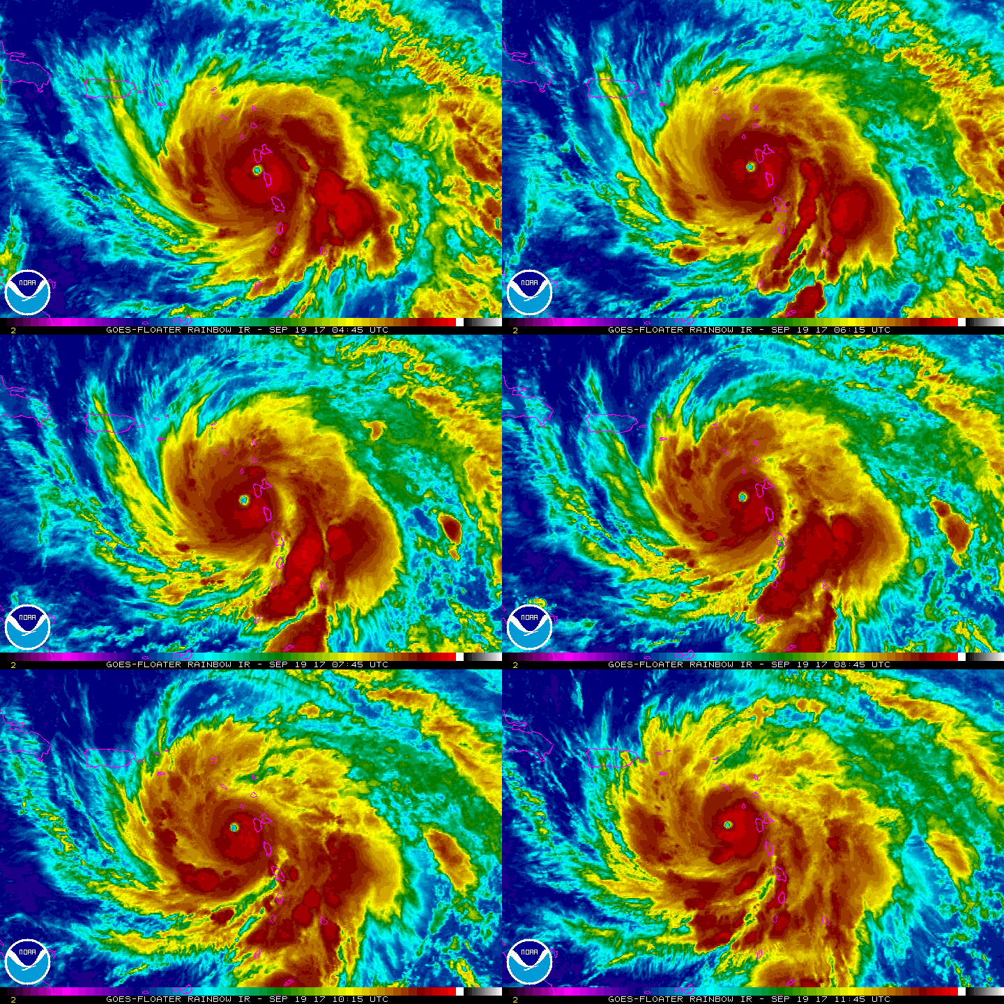
Maria is strengthening, and has reached a Category 5. As you can see from the image below she's much more defined than yesterday and is battering small islands through the Caribbean.
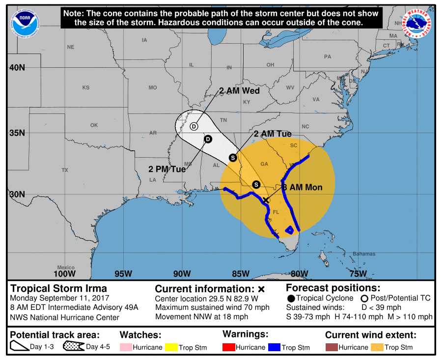
9/11/17 9:15am: Irma is now making her way up the Florida panhandle and fortunately the storm surge has been much less than anticipated, sparing even more flooding throughout the state. The latest forecast from the National Hurricane Center shows Irma rapidly deteriorating and continuing to wander northwest for the next few days. Relatively high winds are expected through Tuesday on the Outer Banks but no significant storm-related damages. OBX eyes are now on Jose as the system may have a decided direction in the next few days.
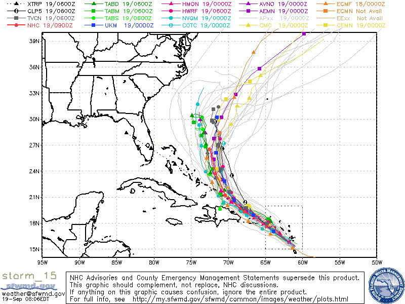
 Here are some forecast models for her future path. All (right now) appear to be taking her offshore in a similar route as Jose. We will continue to post relevant forecast updates as they become available.
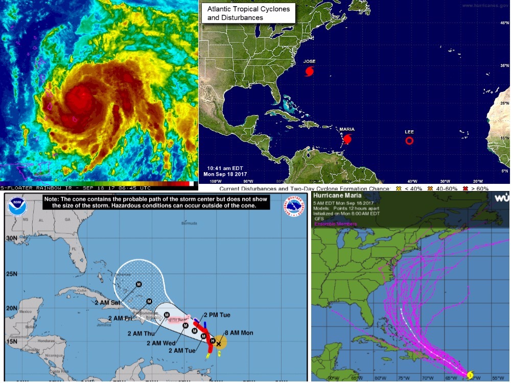
 9/18/17 11:00am: Here's another update as the 2017 Atlantic Hurricane Season is living up to the "more active" prediction. A quick look at any satellite image makes it look like a box of spinning tops has spilled over.
Jose is fluttering by the Outer Banks right now. The system is going to slowly wind down and continue meandering up the Eastern Seaboard bringing with it a few bands of rain and gusty winds. Those winds hitting the OBX now are moderate, nothing above 25-30mph makes this feel like a typical nor'easter or close to it. We are continuing to watch Maria as she seems to be roaming down a similar path as Irma and intensifying along the way.
Maria isn't as organized or well defined as Irma, but it's forecasted to reach Category 4 strength (130-156mph winds) and poses a serious threat right now to the Caribbean. Below are some forecast models and imagery of her position. This far out from the mainland US, it's important to take the forecasts with a few grains of saltwater, but keep vigilant nonetheless. Keep checking back to our blog for important updates as information is available.
 9/11/17 9:15am: Irma is now making her way up the Florida panhandle and fortunately the storm surge has been much less than anticipated, sparing even more flooding throughout the state. The latest forecast from the National Hurricane Center shows Irma rapidly deteriorating and continuing to wander northwest for the next few days. Relatively high winds are expected through Tuesday on the Outer Banks but no significant storm-related damages. OBX eyes are now on Jose as the system may have a decided direction in the next few days.
 9/8/17 8:26am: The 8am National Hurricane Center forecast path shows Irma making a straight on hit into Florida, and rapidly deteriorating into a tropical depression as it makes a more westerly track into the United States. There are still chances the path could fluctuate, but at this time a direct impact on coastal North Carolina does not appear imminent.
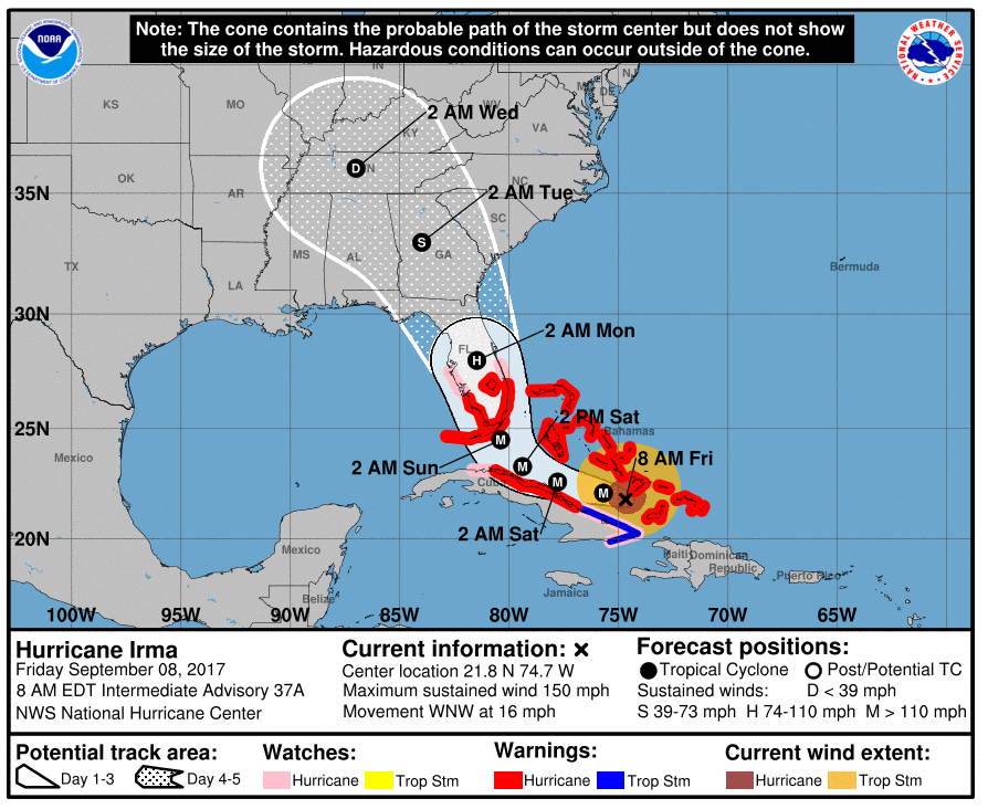 9/7/17 2:05pm: As Hurricane Irma slowly approaches the mainland United States, all of us at Village Realty are closely monitoring the storm and gauging potential impacts it may have on North Carolina and the travel plans of our guests. At this time, there are no evacuation orders in place and it's "business as usual." We strongly encourage any of our in-town or arriving guests to download the Village Realty App.
If you haven’t downloaded this yet, please go ahead and do so now, using the links below:
iPhone Download Link
Android Download Link
We will be communicating any updates regarding Hurricane Irma via the app. If you are not able to download the app, these communications will be sent as an email. We will also be posting information updates on this blog.
Thank you and we will keep you posted on Hurricane Irma as soon as we have more information share.
Sincerely,
Village Realty Rentals

